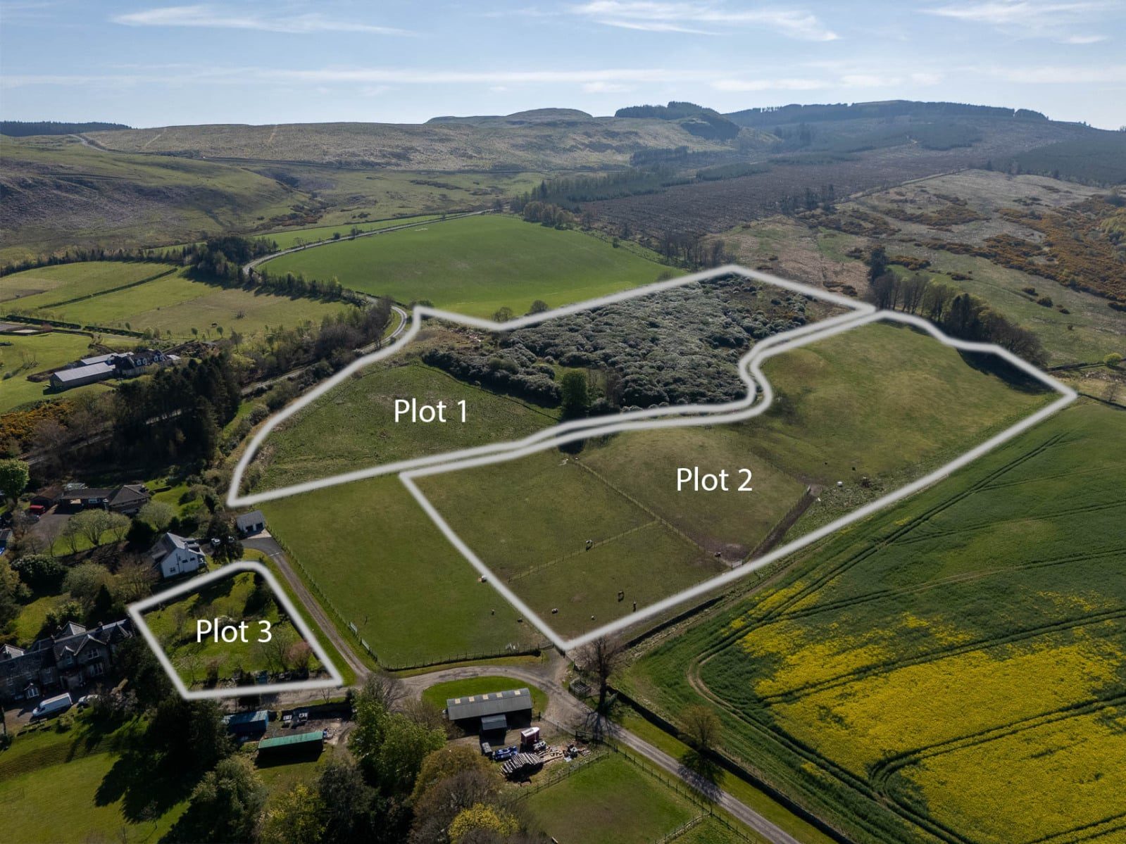
Land
KY13 0LS


What this property offers
About this property
The hill land extends to approximately 3.73 ha (9.22 acres)hectares), of which around 2.5 acres comprise rough grazing. The remaining area is predominantly covered by mature rhododendron bushes.
The land lies at an elevation of approximately 150–160 metres above sea level and, according to the Meteorological Office Average Rainfall Chart, the area experiences average annual rainfall of approximately 1,082mm. The James Hutton Institute Land Capability for Agriculture classifies the land as Class 4.1. The SEPA Flood Risk Map indicates no risk of river flooding; however, it should be noted that there are limited areas identified as having a low risk of surface water flooding. The entirety of the land falls within the Strathmore, Fife and Angus Nitrate Vulnerable Zone (NVZ).
Within the site runs a disused road, which lies parallel to the public hill road. It is understood that water and electricity is available where the access track comes from the public road.
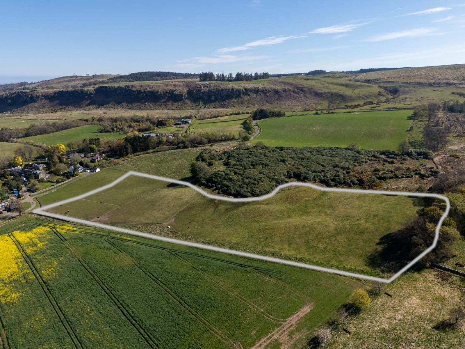
Lot 2 – Equestrian land - 3.11 ha (7.69 acres).
Access to the equestrian land is taken from the main drive directly from the public road, with water and electricity within 100 yards.
The land lies at an elevation of approximately 140-150 metres above sea level and, according to the Meteorological Office Average Rainfall Chart, the area experiences average annual rainfall of approximately 1,082mm. The James Hutton Institute Land Capability for Agriculture classifies the land as partly Class 3.1 and partly Class 4.1. As with Lot 1, the SEPA Flood Risk Map indicates no risk of river flooding, although limited areas are identified as having a low risk of surface water flooding. The entirety of the land falls within the Strathmore, Fife and Angus Nitrate Vulnerable Zone (NVZ).
On 13 November 2025 Planning Consent (Ref. No. 25/00333/FLL) was granted for the erection of stables, arena, barn, storage building and associated works.
Lot 3 – The Walled Garden
The area of ground being offered as Lot 3 is situated within a walled garden and extends to approximately 0.344 acres.
Planning consent was granted on 22 November 2013 (Ref. No. 09/01154/FLL) for the erection of three dwelling houses, two of which have since been constructed. The planning consent for the remaining dwelling remains valid in perpetuity.
Communal services are in place for the provision of water, sewerage and gas, with each surrounding property individually metered. Water is supplied from the mains. High speed fibre broadband has been installed in the area. Drainage is served by a private communal waste water treatment plant shared with other properties at Nivingston, which is monitored by SEPA and serviced annually.
Location
Nearby Properties
Listed by
Bell Ingram
Disclaimer: Property descriptions, images, and related information displayed on this page are aggregated from publicly available sources across the web and presented for informational purposes only. While we strive for accuracy, home.co.uk cannot guarantee that all details are current or complete. This information is provided as a guide only and should not replace professional property advice. We strongly recommend contacting Bell Ingram directly to verify availability, arrange viewings, and obtain comprehensive property documentation.
Added 23 Jun 2026
Bell Ingram
Perth
28
Properties
Quick Actions
Mortgage Advice
Get move ready. Fee-Free mortgage advice to help you secure your dream home
Fee-Free Mortgage AdviceCheck broadband on this home
Compare fibre, cable and 5G speeds from all major providers in KY13 0LS. Check before you move
Set Price Alert
Get notified about price changes